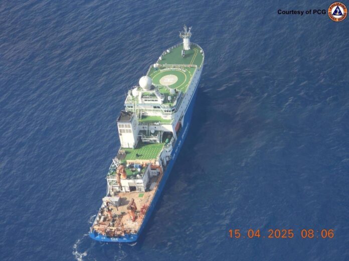
China’s deployment of research and survey vessels in contested waters is a central pillar of its maritime gray zone strategy, allowing Beijing to assert control, gather intelligence, and expand its presence while avoiding direct confrontation, SeaLight reported Wednesday.
Operating under the guise of scientific missions, SeaLight said these dual-use vessels—often state-owned or affiliated with the military—conduct oceanographic surveys and resource mapping that serve both civilian and military purposes.
“These missions blur the line between legitimate scientific research and covert intelligence gathering or strategic signaling, allowing China to expand its maritime presence while maintaining plausible deniability,” SeaLight said in its report.
SeaLight also shared some of Beijing tactics include “going dark” by disabling AIS (automatic identification system) tracking, symbolic pathing (such as drawing Chinese characters on navigation routes), and operating under escort by coast guard or maritime militia vessels to deter interference.
According to the group, these operations offer legal and diplomatic cover, exploiting gray areas in international law and using their civilian appearance to minimize escalation risk.
The goal is incremental advantage: repeated missions normalize Chinese presence in disputed areas like the South China Sea, East China Sea, and even the Indian Ocean—gradually reshaping perceptions of legitimacy and control.
Recent cases include the Haiyang Dizhi 8’s prolonged survey in Malaysia’s exclusive economic zone (EEZ), the Dong Fang Hong 3 and Xiang Yang Hong 01’s mapping of the Ninety East Ridge, and suspicious maneuvers near the Senkaku Islands and New Zealand’s coast, according to SeaLight.
Meanwhile, China actively harasses its neighboring states’ legitimate survey missions, as seen in its aggressive shadowing of Indonesia’s operations in the North Natuna Sea in 2024.
Together, these actions demonstrate China’s calculated use of civilian research platforms as instruments of state power—advancing its strategic aims while keeping regional rivals off balance and avoiding overt conflict.
“Beyond resources and territory, these operations are fundamentally about intelligence. Scientific surveys double as covert intelligence collection, mapping the seafloor, monitoring foreign military and commercial activity, and enhancing China’s operational awareness for both present and future contingencies,” SeaLight explained.
“The combination of civilian cover and military escort is designed to deter interference by regional actors, signaling China’s resolve while complicating any direct response—since confronting a nominally civilian vessel risks escalation and international criticism,” it added.


